
Nan’ao Island Waterfront District
Location Shenzhen, China | Client Shenzhen Bureau of Urban Planning and Natural Resource | Architect Chapman Taylor | Size 296 square kilometers | Status Completed 2019 | Tags Masterplans, Climate Change
The island of Nan’ao is prone to numerous environmental threats triggered by climate change. Rising temperatures alter flora and fauna, deter visitors form enjoying the outdoors comfortably, and instigate storm events. Water is a major challenge. Rainfall flooding and storm surges threaten Xichong’s coast. Strong currents and large tides leave people and infrastructure vulnerable.
The proposed design responds to these challenges, viewing them as opportunities to develop innovative, imaginative solutions to protect Xichong Nan’ao and enhance its cultural and economic character for years to come. With a coastal resiliency approach, 5 levels of defence are proposed.
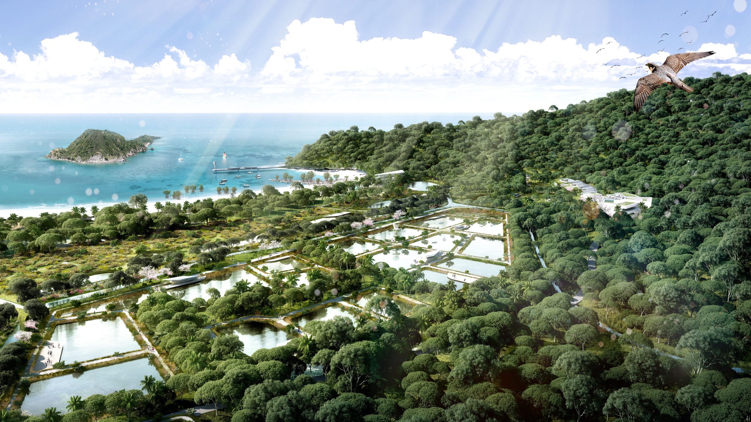
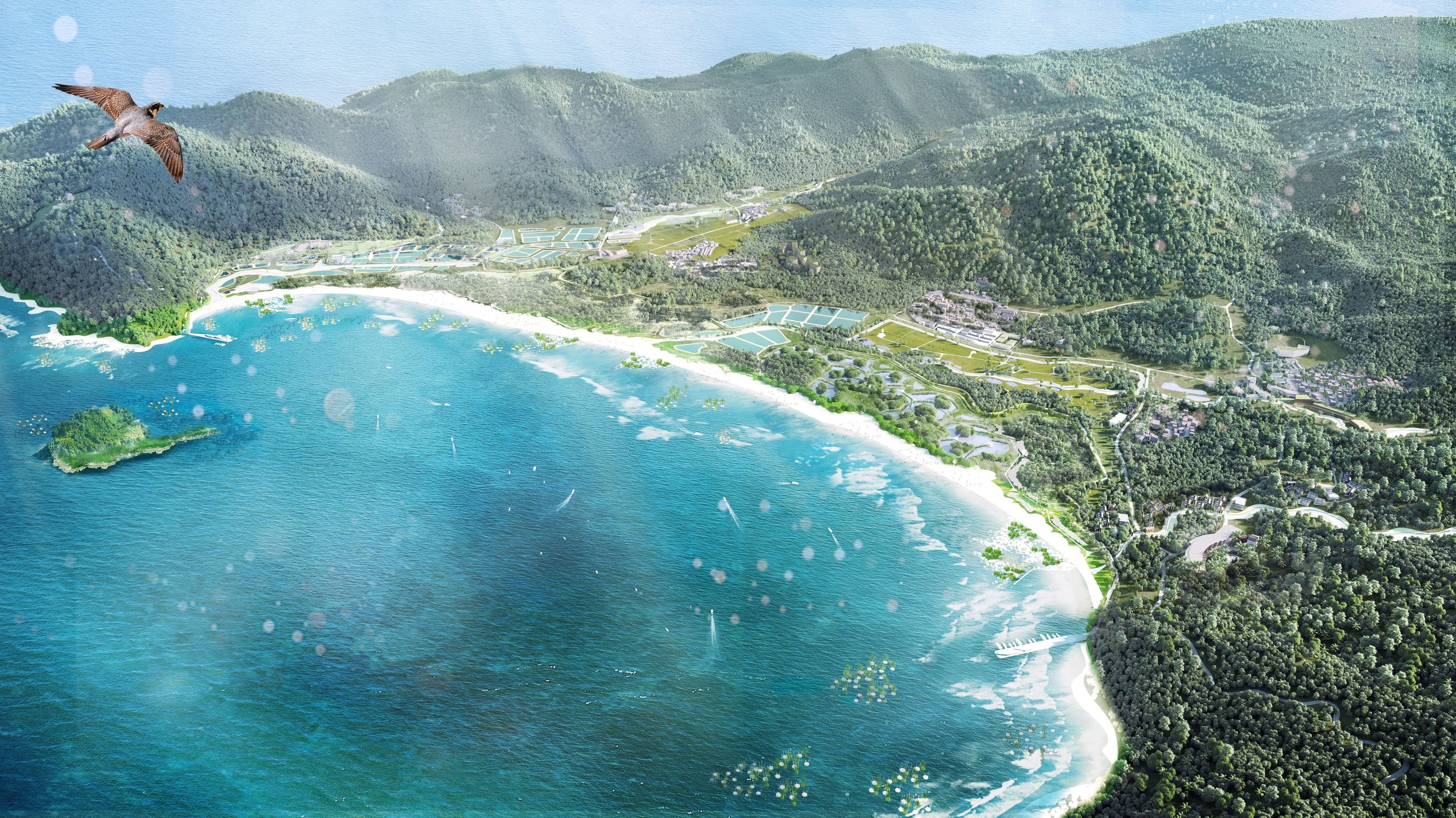
Level 1 is a Sea Barrier comprised of artificial reefs, floating breakwater islands, eco-piles and tidal pools. The artificial reefs help buffer and enhance existing coral reefs that are in decline. Floating breakwater islands include habitat for aquatic life while providing wave attenuation. Eco-piles inserted into the shoreline stabilize shifting sediment. Tidal pools absorb water while providing opportunities for water play. These elements work together to protect the coast, while offering a range of tourism activities including swimming, nature play and coastal ecological education.
Level 2 is a Costal Dyke comprised of reinforced sand dunes used to slow, filter and absorb water. Cultural dunes integrated beach facilities and terraced edges, environmental dunes include sand fences and vegetation for stabilization.
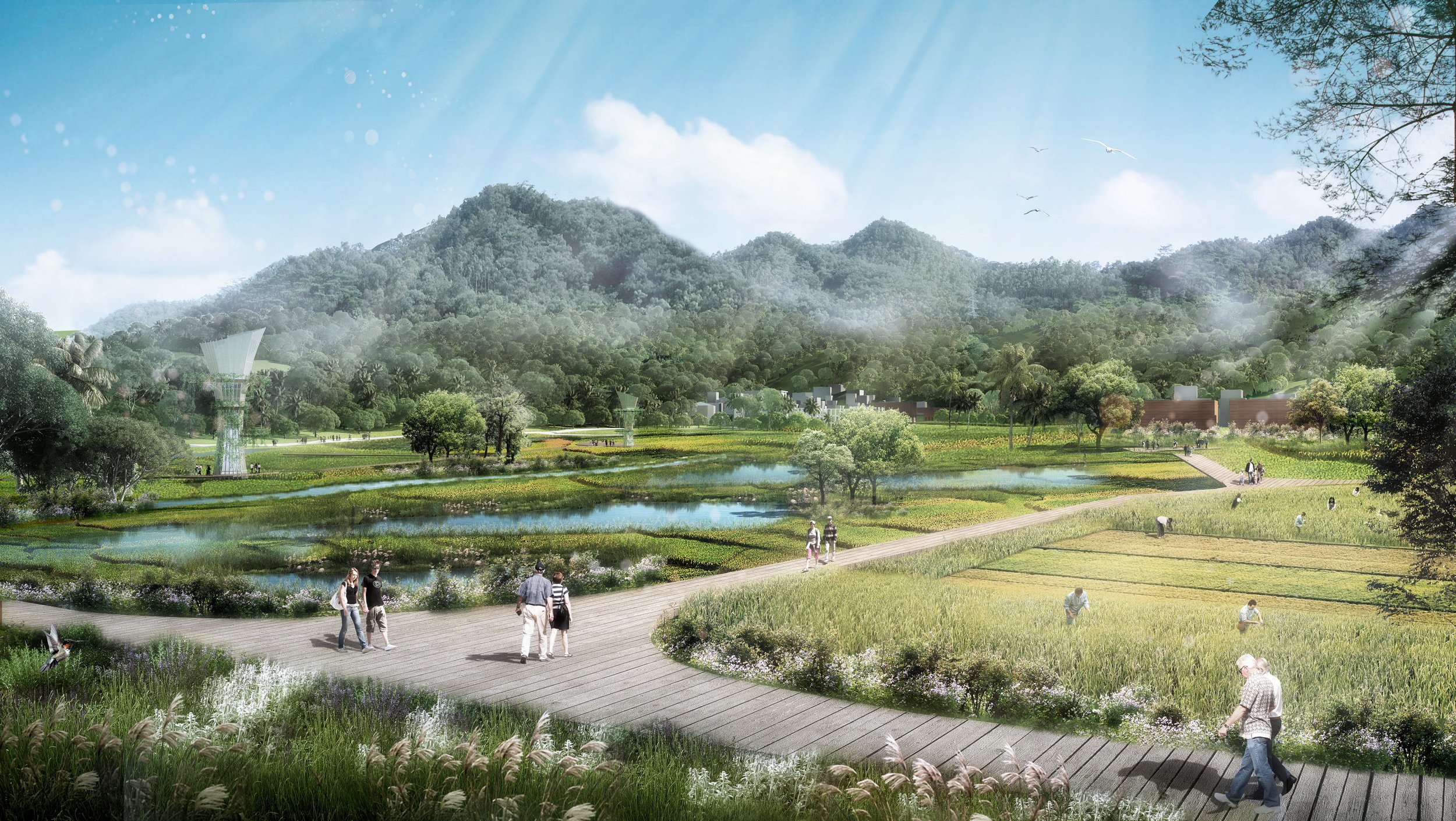
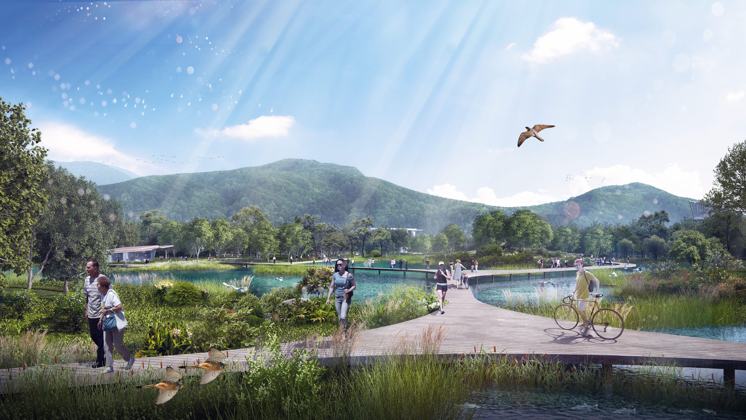
Level 3 is the Eco-Park. An expansive area of coastal wetlands and woodlands allow the site to flood when water surpasses the Sea Barrier and Coastal Dyke. This large eco-zone includes mangrove vegetation, native wetland species, and afforestation strategies to maximize ecology and biodiversity while providing carbon sequestration.
Level 4 is the Inland Dyke, a continuous green spine weaving through and connecting the site. With lush vegetation and topographic synthesis, the dyke is an ecological levee. It includes activities such as walking, hiking and cycling and serves as an armour to protect people, villages and infrastructure during extreme storm events.
Level 5 is a series of retention ponds located adjacent to the site’s rivers. During storm events and heavy rainfall periods, the ponds absorb overflow water and alleviate pressure on the rivers. Riverside vegetation helps to slow high water velocity.
The five levels of defence work together as a holistic, resilient system. While protecting the site, they welcome visitors to a range of coastal ecological experiences providing education and awareness of the value and beauty of Nan’ao. Here, environment, culture and economy prosper together for years to come.